
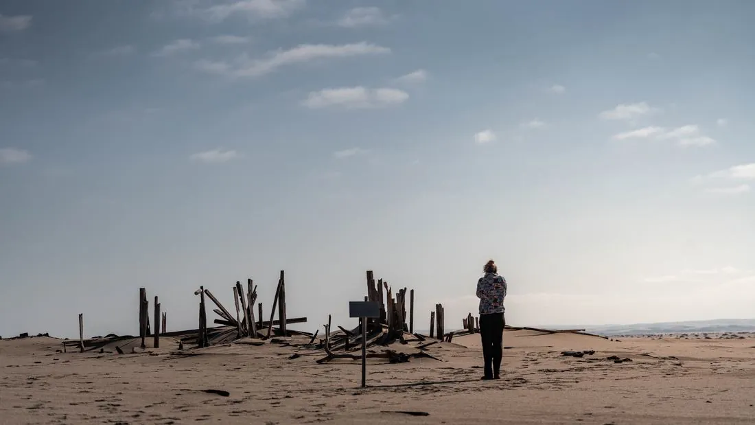
The bones are the first thing you notice. Whale vertebrae the size of a bar stool, bleached white and lying on open sand a long way from any water deep enough to have held the animal they came from. Then the ships — broken open along the tideline, going back to rust, older than most of the maps of this coast. The Portuguese called it the Gates of Hell. It has also been called the Coast of the Dead. Both names describe the same five hundred kilometres of Namibian shore, and both were earned.
Eight vehicles drove it, north, and then kept going. Across the Kunene into Angola, up over the escarpment to Lubango, back down to the Atlantic, and then south into Iona National Park — fifteen thousand square kilometres of desert that almost nobody drives. Fourteen days, three countries, and a camera running the whole way.
The plan
The convoy formed up at Swakopmund and ran north inside the Skeleton Coast concession, camping wild at Möwe Bay and then at Bosluisbaai, about fourteen kilometres short of where the Kunene meets the sea. There is no border post on that coast — none exists — so the route does what every expedition through this concession does: it crosses the dune belt eastward, comes down the Hoarusib to Purros, and only then turns for the border. The last night in Namibia was at Raycana, on the Kunene about eight kilometres from the Ruacana post.
From there it is Angola: Lubango first, over the Serra da Leba; then Moçâmedes on the coast; then south to the red sandstone at Colinas, to the Lion’s Cave inside Iona, and finally to Tchinhungua, a camp on the Cunene deep inside the park. Ten stops. The straight-line distance between them is 1,709 km, which is the number we can stand behind — road distance is materially higher and the odometer figure is not in yet.
Namibia
The Skeleton Coast is not difficult because of the driving. It is difficult because of what is behind it. Cold water off the Benguela current meets desert air and holds the shore under fog for much of the year; beyond the surf there is a sandbar, and beyond that nothing in any direction for hundreds of kilometres. Sailors who made it to the beach had survived the wrong half of the problem. The convoy ran salt road and beach north through that, past the wrecks, to the top of the coast.
What the coast does to a vehicle is quieter and more expensive. Salt air gets into everything unpainted and everything unsealed, and it does not stop when you leave. Air intakes matter here for dust rather than water, and the filter behind the snorkel is doing the work nobody notices until it has not been done. Tyre pressure is the other constant — sand runs at one pressure and gravel at another, and the distance between them is a compressor and about ten minutes.
The Kunene mouth
The northern end of the concession is where the Kunene runs out into the Atlantic, and it is the far end of the shipwrecks. One of them was the Dunedin Star, which grounded on this coast in November 1942. What happened after she grounded is a longer story than a paragraph — a tug and an aircraft both came to grief trying to reach the survivors — and it is worth reading properly before you drive past the place.
The crossing
Ruacana is the crossing. It is not a matter of preference: there is no border post at the Kunene mouth and none anywhere along the coastal reach of the Iona–Skeleton Coast transfrontier area, so the only alternatives are Ruacana or Oshikango, 180 km further east.
Ruacana is tarred on the Namibian side and becomes a rough unpaved track on the Angolan side, heading north towards Lubango. Vehicles need a temporary import permit and every occupant needs a visa arranged in advance — neither is obtainable at the post. Posted hours differ between sources, so treat the published times as indicative and confirm before you plan a day around them. If you want tar on both sides, Oshikango is the crossing, at the cost of the extra distance and a duller drive.
Angola
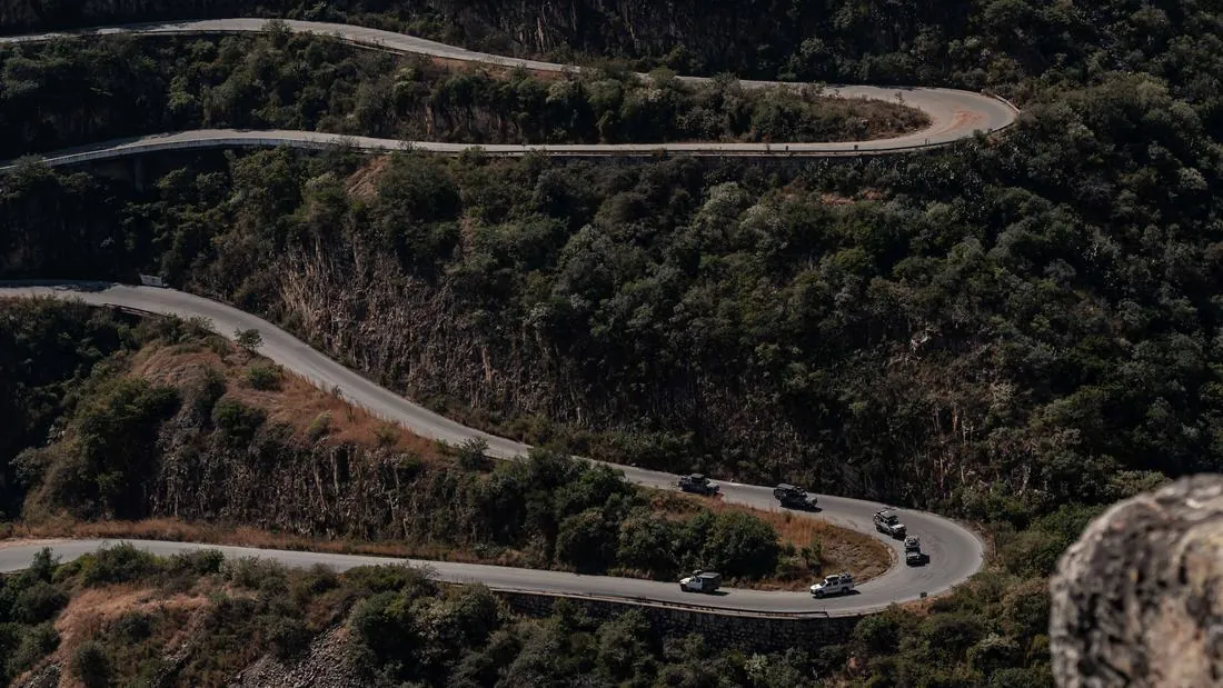
The thing the guidebooks get wrong about southern Angola is the scale of the empty. Lubango sits high, and the Serra da Leba drops off the escarpment in a set of switchbacks that appear on every postcard of the country and are better in person. Below that is Moçâmedes and the coast, and below Moçâmedes the road runs out of towns.
Colinas do Curoca is red sandstone canyon country between Moçâmedes and Tômbua — wild camping, nothing in any direction, and, contrary to most write-ups, just outside the northern boundary of Iona rather than inside it. South of there the ground turns to dune. This is where the convoy spent its recovery gear: deep, soft sand where the difference between floating and digging is a few points of pressure and a bad line, and several vehicles found the bad line. The Defender 110 broke on this leg, and was fixed on the same leg, out on the sand with what the convoy was carrying. That is the part of overlanding nobody puts in a brochure and everybody remembers.
Iona
Iona National Park has been co-managed by African Parks with the Angolan government since 2020. It is the northern reach of the Namib, roughly fifteen thousand square kilometres, running from the Curoca River in the north to the Cunene in the south and rising eastward to the escarpment. It is the main habitat of Welwitschia mirabilis, which draws its water out of sea fog. Angolan giraffe were reintroduced here in 2023, having been locally extinct since the 1990s.
The crossing into the middle of the park is the hardest driving of the fortnight — a mountain section that has to be worked rather than driven — and it ends at Gruta do Leão, the Lion’s Cave, which is a park campsite in the proper sense of the phrase. The convoy was welcomed by the community that lives alongside the park, and the park’s community manager walked the crew through how conservation here actually works: what the park and the people around it each put in, and what each gets back. It is the most interesting conversation of the trip, and none of it involves a low-range lever.
The last night was at Tchinhungua, on the bank of the Cunene and still inside the park. It is a listed communal-zone campsite on Iona’s own map and it does not appear on Google Maps at all, which is a fair summary of this end of the route. It is also difficult to describe without sounding like an advertisement, so we are not going to try.
What it proved about the gear
Nothing on these vehicles was chosen for the camera. The front bars are the part that meets an animal first and the mount everything else on the nose hangs off. Lighting was Lightforce, judged on one-lux distance rather than wattage, which is the only number that describes how far you can still see something. Air and induction was a snorkel and the filter behind it, doing dust work all day. Fuel got a Direction Plus pre-filter and catch can, on the principle that the cheap consumable should fail before the expensive part does.
Suspension is the item you feel on every kilometre rather than only on the ones that go wrong, and the choice that matters is the rear leaf rating — picked against the load carried every day, not the load carried once a year. Power and the cold chain ran off an Intervolt charge system, EcoFlow storage and 4x4 Equip cold storage; get the charging wrong and the rest of it is luggage. Recovery gear was carried where it could be reached without unpacking the vehicle, which is the only place it is any use. Every one of those items is marked up on the vehicle on the expedition page, with what it is and what it does.
Eight vehicles went. Every one of them came home.